
HIKE: Agua Blanca to Cruz de los Cruces 6 May '18
On the South side of the Picachos, 45-50 minutes away via Comonfort, is town called Agua Blanca.
It is a friendly town. The kids come up and talk to you. It is off the beaten track and fine-looking horses are a common way to get
around. Practically the whole town goes off shrimp fishing in Louisiana for 3 months, annually. They are happy to talk English too.
Our hiking group gets down here less than once a year. So I am going to emphasize the route description in this write-up. It is not a simple
trail to follow.
Coming right off the mountain, running through the village is a clear stream of water which can spill up to 2' deep over a road causeway which leads to a neighboring town called Rincon de Purgatorio (Corner of Hell). If you follow the road which leads up from this causeway curving steeply up the hill (the main drag if you will), you will come to a canyon leading Westward. You may have to negotiate an animal pen to get to a steep rocky trail on the Southern canyon slope. At the first gate (or optionally soon after) cut over a stone-wall/fence in a
North-Westerly direction and soon you will come to an earthen dam. Towering above you is cliff-sided La Mesa – a large expanse of
almost square level ground. Seen from elsewhere on the Eastern ridges, we have nicknamed this the helicopter landing pad.
North, uphill from the dam, there are two routes which pass on either side of La Mesa. The Eastern trail leads under mean-looking cliffs – not for the faint-hearted. We took an upwards route on the West side which could have led to access to La Mesa iself.
West across the canyon.
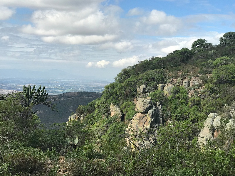
HIKE: Agua Blanca to Cruz de los Cruces 6 May '18On the South side of the Picachos, 45-50 minutes away via Comonfort, is town called Agua Blanca. It is a friendly town. The kids come up and talk to you. It is off the beaten track and fine-looking horses are a common way to getaround. Practically the whole town goes off shrimp fishing in Louisiana for 3 months, annually. They are happy to talk English too.Our hiking group gets down here less than once a year. So I am going to emphasize the route description in this write-up. It is not a simpletrail to follow.Coming right off the mountain, running through the village is a clear stream of water which can spill up to 2' deep over a road causeway which leads to a neighboring town called Rincon de Purgatorio (Corner of Hell). If you follow the road which leads up from this causeway curving steeply up the hill (the main drag if you will), you will come to a canyon leading Westward. You may have to negotiate an animal pen to get to a steep rocky trail on the Southern canyon slope. At the first gate (or optionally soon after) cut over a stone-wall/fence in a North-Westerly direction and soon you will come to an earthen dam. Towering above you is cliff-sided La Mesa – a large expanse ofalmost square level ground. Seen from elsewhere on the Eastern ridges, we have nicknamed this the helicopter landing pad.North, uphill from the dam, there are two routes which pass on either side of La Mesa. The Eastern trail leads under mean-looking cliffs – not for the faint-hearted. We took an upwards route on the West side which could have led to access to La Mesa iself.A bit above the level of that plateau, we tracked almost due West and found ourselves on the edge of a deep canyon. Picture lookingWest across the canyon.
May 11, 2018May 11, 2018PierreNel|
7701FEE6-BC69-4CAC-A983-3D65A446F3FE
Upload Date: May 10, 2018 08:53 PM
Show Photo Info
Close |
Today we continued above the canyon, crossed the stream that fed those falls below, and continued further North along the west bank until we saw a route that led through clearing in the scrub due West of us. At a N-S wall, do not cross, but head North on a steady upwards
course. This path dissipates but keep a look-out for a substantial rock wall on your right. You will eventually cross this wall and head further North to the Crus de las Cruces, up grassy slopes now on the Eastern side.
To get the picture, recognize that after the stream crossing, you headed to the more Western side of a ridge which leads North. The Eastern side of this ridge is a more-or-less impassable with heavy growth – we have tried it before: it took all day and we still didn't make it
to the cross! The cross is encountered after topping (~8,800'), the end of this long ridge. There is also a valley route, dodging thorny
scrub along the stream and then on up more grassy slopes, but this Western route makes for the fastest time by far.
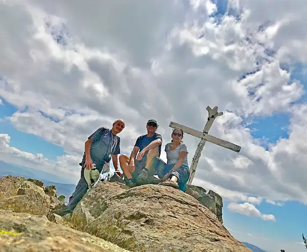
Stella, Greg, the Cross at ~ 8.700'
May 11, 2018May 11, 2018PierreNel|
Stella Jeff Coss @ 8.700'
Capture Date: May 10, 2018 08:57 PM
Show Photo Info
Close |
Having topped the ridge and heading briefly downwards again, the cross appears on the edge of an Eastern cliff – with an expansive view. Having started below 7,000' at 9 am, we arrived at about 11:45. Geoff and Stella are no slouches – they had me running to keep up. Just us three on this hike – nobody for me to use as my excuse for calling a halt.
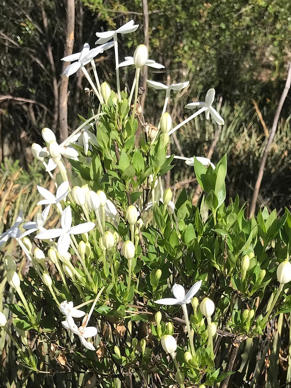
Huele de Noche were found in shrub-sized clusters on this trail. Usually they are found as low bushes.
May 11, 2018May 11, 2018PierreNel|
Cluster of Huele de Noche
Upload Date: May 10, 2018 08:53 PM
Show Photo Info
Close |
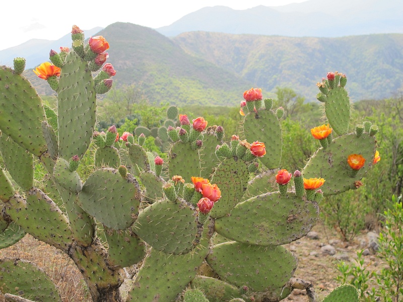
Getting ready for spring
May 11, 2018May 11, 2018PierreNel|
Preparing for Spring
Capture Date: May 10, 2018 08:55 PM
Show Photo Info
Close |
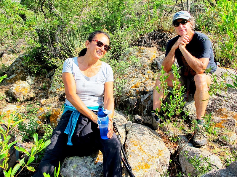
Stella Geoff - taking a rare break (below)
May 11, 2018May 11, 2018PierreNel|
Stella Geoff taking a rare break
Capture Date: May 10, 2018 08:54 PM
Show Photo Info
Close |

Pierre, Geoff, Stella at the Cruz de las Cruces
May 11, 2018May 11, 2018PierreNel|
Pierre Geoff Stella at Cruz de las Cruces
Upload Date: May 10, 2018 08:54 PM
Show Photo Info
Close |
This part is familiar territory usually reached by several routes from the Eastern side of these mountains. We made this hike circular by following the familiar Eastern route down, until we could clearly see the ridge which terminated with the distant La Mesa. Then we turned South, with no defined trail, dodging from clearing to clearing on the proximate top of this ridge.
After crossing an E-W stone wall, look for a larger wall on your East (left) side which marks the more precipitous terrain leading to huge
cliffs to the East of La Mesa. Before you reach La Mesa, you need to cross this wall and head down a very precipitous route to get down the Eastern cliff. That cliff is unstable and if you fall, you will bounce once after several hundred feet and then find yourself launched over another ~ 1,000 feet of mixed trees, cliffs and impassable steepness. There is only one (1) passable down- route here!
DO NOT ATTEMPT to climb down here unless you are with someone who actually recognizes the precise spot.
Do not take a chance on finding this route without first arranging for recovery of your body. Rather TAKE THE SAFE ROUTE back, by crossing La Mesa West at its upper end and heading South down the Western slope trails to the dam!
With Geoff fearlessly out in front (Isn't he nice - he believed me, when I said this was a trail!) we zigged and zagged down this cliff. Eventually we found ourselves on a more horizontal route, leading below the cliff-face. There had been fresh rains – even the night
before – which made the narrow trail perilously slippery. This was not a Sunday picnic walk!
Breathing after passing down, then under those formidable cliffs.
May 11, 2018May 11, 2018PierreNel|
Breathing after coming down those cliffs
Capture Date: May 10, 2018 08:56 PM
Show Photo Info
Close |
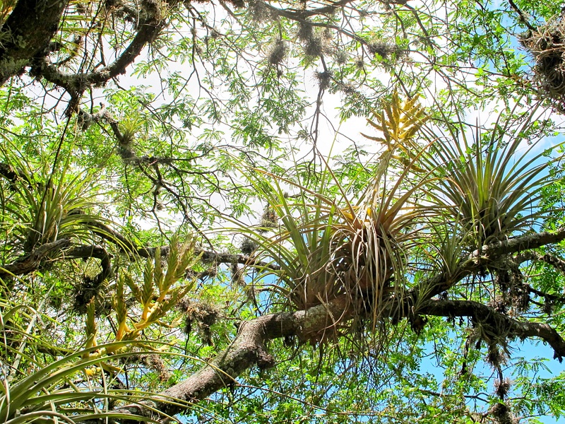
Bromeliads
May 11, 2018May 11, 2018PierreNel|
Bromeliads
Capture Date: May 10, 2018 08:55 PM
Show Photo Info
Close |
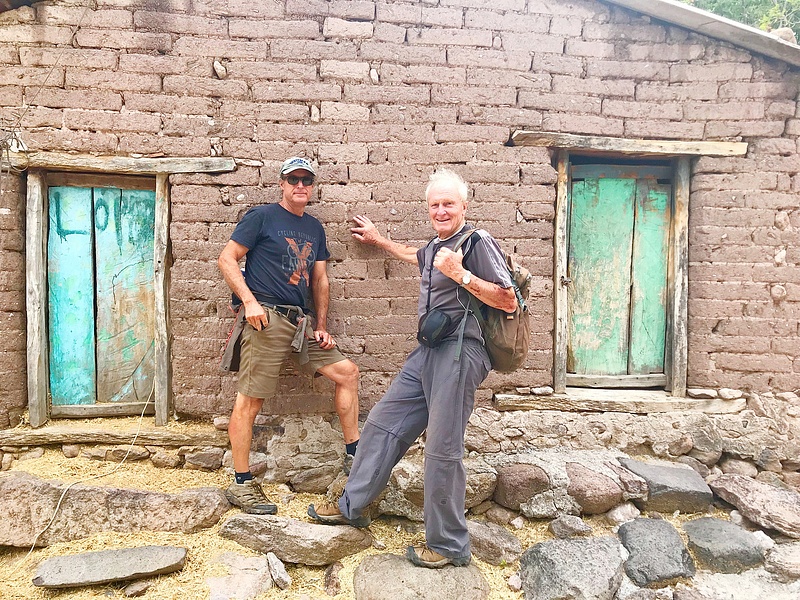
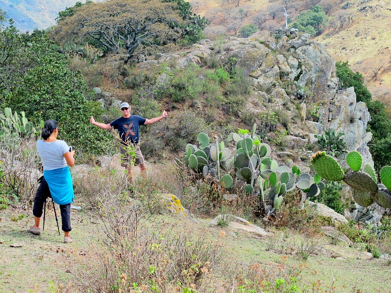
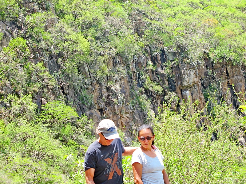
Geoff, Pierre in the village
May 11, 2018May 11, 2018PierreNel|
Jeff Pierre in the village
Upload Date: May 10, 2018 08:56 PM
Show Photo Info
Close |
From the dam we took the same rocky trail down to the village where we were quaffing a beer in a tienda with friendly kids around,
before 3 pm. We had covered about 7 strenuous miles at a good clip.
Congratulations on your one-year anniversary since your arrival in San Miguel, Jeff and Stella! Thanks for another great companiable hike! Don't know of any encore to match this, for next Sunday! You have done most of our collection of Picacho trails now – minor variants are mostly what is left.
Pierre

|